|
HURRICANE HARVEY
RECOVERY INFORMATION
Tuesday, September 5, 2017
We have confirmed 60 homes to
have recieved flood water from Hurricane Harvey. The
amount of water in the living space ranges from 1
inch to 36 inches. Seven of the 60 homes have
'affected' damage. Forty-one of the 60 have 'minor'
damage. Twelve have damage that is still
undetermined. The estimated dollar loss (structure
only, not including contents) is $521,273 for those
48 affected and minor damaged homes.
An additional 19 homes are
suspected to have had some level of flood water
inside the living area. However, flood damage to
these homes have not been confirmed.
Friday, September 1, 2017
The City of Shoreares is
quickly recovering from the affects of Hurricane
Harvey. The water has receded and all city streets
are open.
While several homes have
suffered flooding this has been a far different
experience than Hurricane Ike in 2008.
A preliminary survey of city
facilities has shown extremely little damage. The
Police Department reports no water inside or damage
to their building, and no damage to police vehicles.
The Public Works Department reports 5-inches of
water in the shop but no damage to the building or
equipment, no water in the offices, and no damage to
vehicles. None of our five water and sewer
facilities were disrupted or damaged by the storm or
flooding. Water pressure was never lost and
utilities operated as normal throughout although
flood water cause sewers to drain slowly and two or
three homes reported a back-up in their showers.
While there were some
electrical outages they were limited in both area
and duration. There were no widespread telephone
outages and cellular telephones worked throughout the
storm.
As of this morning (8/31) we
believe that there may be about 75 homes that had
some amount of water in them, however only 14 have
been confirmed to have had storm water inside living
space. As of Wednesday, August 30, there were no
homes with living space remaining below the water
level.
| Home with Confirmed
Flooding |
0.25-6" |
6.25-12" |
12.25-36" |
Over 36" |
|
| 14 |
7 |
3 |
4 |
0 |
|
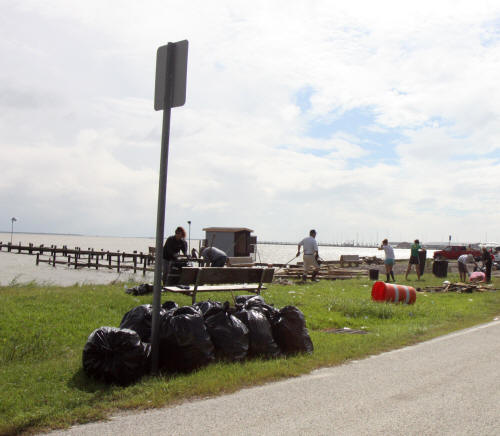
Storm debris on city's
waterfront on Galveston Bay has already been cleaned
up by volunteers. This time heavy equipment wasn't
required and the debris was small enough to be put
into plastic bags!
Did Your House Flood?
Wednesday, August 30 - 8:30 AM
Did you get flood water in
your house? If so, we need to know so that we can
help you and your neighbors get assistance to
recover from this storm.
If you had any amount of
water on your lowest living level please let us know
as soon as possible.
You can call us during
business hours at 281.471.2244 or email the City
Manager at dstall@cityofshoreacres.us or fax us at
281.471.8955.
Here's the information we
will ask for:
•
Name.
•
Address.
•
Best contact
telephone number.
•
Email address.
•
Estimated maximum
height of the water in your house (inches)?
•
Do you currently
have electric power?
•
Is the house
currently livable?
•
Are you staying in
the house now?
•
Did you get water
in your garage?
•
Do you have flood
insurance?
That's it! Super simple, easy
and fast to reply to. If you send an email just
answer these ten questions and your done!
The sooner we can get this
information, the sooner we will be able to get
assistance.
Please call now, we're
waiting for your call today! 281.471.2244
Did A Fallen Tree
Knock Your House Power Line Down?
Tuesday, August 29 - 3:42 PM
Did you have a tree (or
anything else) pull your home's electrical service
drop down? If so please call us at City Hall and
we'll work with your electrician and CenterPoint
Energy to get your service restored as soon as
possible, even on the weekend, or after normal
hours.
City Hall can be reached at
281.471.2244
If you can't call during
business hours email me at
dstall@cityofshoreacres.us
David K. Stall, CFM, TEM
City Manager / Floodplain Administrator
City of Shoreacres
dstall@cityofshoreacres.us
No Trash Collection
Monday August 29
Normal residential trash
collection will resume on Friday, September 1.
Storm Update
August 27, 2017
At
5pm tonight water levels are starting to slowly
drop.
That includes
Galveston Bay, Taylor Bayou, and Clear Lake.
Additional rain this evening might slow or reverse
that, but we expect lower levels and reduced street
flooding in the morning. Of course we don't have a
crystal ball, so that could change.
Curfew In Effect
Sunday, August 27 - 8:34 PM
The Mayor has ordered an
emergency curfew in the city of Shore acres that
will be in effect from eight o'clock tonight until
six o'clock in the morning.
No one should be on the
streets during those hours except for travel to and
from home.
Please carry your
identification and proof of residency if you need to
leave your home during the curfew tonight.
City Hall will be
Closed Monday, August 28th
Sunday, August 27 - 6:10 PM
We are going to give the
storm one more day before bringing staff back to
city hall. Unless streets remain flooded, we plan on
being open for business Tuesday at 8:00 am to 5:00
pm.
Police and Public Works may have reduced staffing
Monday, but will be available.
City Water & Sewer
Throughout this storm city
water and sewer facilities and associated equipment
continued to function as usual.
There has been no loss of
water pressure or disruption of safe drinking water.
The
city's wastewater pumping stations continued to
operate through the storm. Unfortunately however, we
cannot keep floodwater out of our underground sewer
collection lines. We are pumping extraordinary
volumes of water to be treated. That extra storm
water is competing with our wastewater and has
filled our sewer pipes to capacity. As long as we
have floodwater in the streets (anywhere) your
plumbing fixtures may be slow to drain or flush.
Under these circumstances
there is always a risk that your sewer pipes might
back-up. If so, the first place you should see
wastewater will be in your shower or bathtub. In the
majority of cases of back-ups caused by flooding
conditions the back-up will be temporary and will go
back down on it's own. Plunging or plugging your
pipes would not be effective and is not recommended.
Once the wastewater recedes rinse your shower and/or
bathtub with water mixed with a cup of common
bleach.
If Your Home Floods
Sunday, August 27 - 1:20 PM
Sadly, we know that some of
our neighbors have had unwelcome floodwater in their
home as a result of the tides and rains the
accompanied Hurricane & Tropical Storm Harvey. If
you have suffered flood damage it's not too early to
start your recovery.
Start The Claims Process By
Notifying Your Insurer
As soon as possible after
experiencing a flood, contact your agent or
insurance company to file a claim. Make sure you
have the following information handy:
•
The name of your
insurance company
•
Your policy number
•
A telephone and/or
email address where you can be reached at all times
An adjuster should contact
you within a few days of filing your claim. If you
do not hear from an adjuster, you can contact your
insurance agent or company again.
Document The Damage
Separate damaged from
undamaged property. Your adjuster will need evidence
of the damage to your home and possessions to
prepare your repair estimate.
Take photographs of all of
the damaged property, including discarded objects,
structural damage, and standing floodwater levels.
Make a list of damaged or
lost items and include their date of purchase,
value, and receipts, if possible.
Flooded items should be taken
out of your home and set outside. If your damaged
property is set at the edge of the street, the city
will remove and dispose of it as soon as possible.
Stay Engaged
This dangerous storm is not
over. Stay vigilant and monitor this storm for
impacts it will continue to have to our area
including more heavy rain, gale force winds, extreme
tides, and possible tornadoes. These conditions may
continue through Wednesday, August 30.
High Tide & Flooding
Sunday, August 27 - 7:54
AM
Tropical Storm Harvey
continues to present a very serious and real threat
to the City of Shoreacres.
At 7:00 a.m. this morning the
city is experiencing major street flooding citywide.
Overnight the city received 14 inches of rain that
has overwhelmed our drainage systems. Tides remain
high and the city is under a Flash Flood Warning
until 10:45 this morning.
As we receive more rain, more
flooding will occur. Residents in low-lying and
flood prone areas of the city may see flooding
inside homes. Stay inside. Move to upper floors. Do
not go into attics to escape high water.
Hurricane Harvey
Saturday, August 26 -
11:21 AM
This is an important message
from the City of Shoreacres. Although Hurricane
Harvey has moved inland, Galveston and the Houston
area continue to receive heavy rain bands moving in
from the Gulf of Mexico. The wind associated with
this system will push Galveston Bay tides even
higher today. As a direct result we expect to see
more street flooding making travel in some areas of
Shoreacres difficult. If another two or three feet
of storm tide will affect your property please take
immediate action to prepare for flooding.
Drive Slowly! Please!
Flooded streets may be
passable if you have a high-clearance vehicle such
as a truck or utility vehicle. However, forging
through high-water can cause wakes that throw water
into property that would otherwise be above the
water level. Unfortunately, some homes,
garages, and stranded vehicles that were still a few
inches above flood water have been flooded by water
surges created by wakes thrown by vehicles driving
through high water. PLEASE, avoid
driving on flooded streets. If you MUST drive
through high-water PLEASE drive slow enough not to
cause a wake the may damage other people's property.
Stay Engaged While Hurricane
Harvey has currently moved into the central Texas
coast this tropical storm remains unpredictable.
Most recent projections have this storm slowly
moving towards Houston over the next several days.
Stay vigilant and monitor this storm for impacts it
will have to our area including heavy rain, gale
force winds, extreme tides, and possible tornadoes.
These conditions may continue through Wednesday,
August 30. Please monitor local media for weather
updates.
High Storm Tide
Saturday, August 26 - 10:29 AM
Although Hurricane Harvey has
moved inland, Galveston and the Houston area
continue to receive heavy rain bands moving in from
the Gulf of Mexico.
The winds associated with
this system will push Galveston Bay tides even
higher today. As a direct result we expect to see
more street flooding making travel in some areas of
Shoreacres difficult.
Take Action
If another two or three feet
of storm tide will affect your property please take
immediate action to prepare for flooding.
Stay Engaged
While Hurricane Harvey has
currently moved into the central Texas coast this
tropical storm remains unpredictable. Most recent
projections have this storm slowly moving towards
Houston over the next several days.
Stay vigilant and monitor
this storm for impacts it will have to our area
including heavy rain, gale force winds, extreme
tides, and possible tornadoes. These conditions may
continue through Wednesday, August 30.
Hurricane Harvey
Friday, August 25 - 7:21 AM
Hurricane Harvey has become a
very large storm that presents a very serious and
real threat to Texas coastal communities, including
the City of Shoreacres.
Voluntary Evacuation
Requested
At 7:00 a.m. this morning
Mayor Sanford has called for the voluntary
evacuation of residents in low-lying and flood prone
areas of the city. Elderly residents as well as
those with medical conditions are also encouraged to
evacuate.
Because of the potential of
heavy rain, street flooding, and traffic leaving the
area, residents evacuating are asked to leave by
noon today, Friday, August 25.
Stay Engaged - Storm Surge Watch
While Hurricane Harvey is
currently tracking into the central Texas coast
tropical storms can be unpredictable.
We are currently under a
Storm Surge Watch and this storm is forecast to move
east into the Houston area after making landfall.
Stay vigilant and monitor
this storm for impacts it will have to our area
including heavy rain, gale force winds, and possible
tornadoes. These conditions may continue through
Tuesday, August 29.
|